Duration 2 days
Max Elevation 2840m
Standard easy-medium
Season October to May
Start Ghorapani
Finish Ghandruk (or Chhomrong)
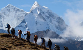
Summary Use this route to combine a visit to Annapurna Sanctuary, or a visit to the Gurung village of Ghandruk, with the Jomsom or Around Annapurna treks.
It is a long day from Ghorapani to Ghandruk, especially if you have climbed to Poon Hill in the morning or the trail is snow-covered. In the opposite direction, from Ghandruk to Ghorapani, it’s even tougher. In either direction, it’s best to break the trek in Tadapani, not only to make the trekking easier, but also for the excellent mountain views. Few local people use this trail, but it is becoming an increasingly important trekking route, and there has been overwhelming and uncontrolled development of the area. Villagers have chopped down large parts of what was once an unbroken forest of rhododendron to build hotels. In 1993 ACAP, in collaboration with local village-development committees, wisely banned the use of firewood between Ghorapani and Ghandruk, so all lodges should be using bottled gas or kerosene for cooking. Unfortunately the ban does not yet apply to Ghorapani.
THE TREK
Day 1: Ghorapani to Tadapani
3-4 hours, 550m ascent, 710m descent The trail starts beside the Dhaulagiri Hotel in Ghorapani and climbs east on a muddy path through deep forests. It finally emerges on a grassy knoll at 3170m that offers good mountain views similar to those from Poon Hill, including a view of Machhapuchhare (not visible from the Ghorapani pass), and a panorama all the way south to the plains of India. Keep climbing along the ridge in pine and rhododendron forests to a crest at 3210m. Descend on the north side of the ridge along a muddy trail interlaced with tree roots to two lodges and a collection of souvenir stalls in a clearing called Deorali at 3090m. A trail leads west from here to connect to the Ghorapani—Tatopani trail at Chitre. Nearby is a viewing tower on a ridge known as ‘Gurung Hill’.
The Tadapani trail descends to the small Lali Guras Lodge in a rhododendron forest, then follows a stream bed. A ridge hides the mountains as the trail makes a steep, sometimes treacherous, descent on a narrow path alongside the stream, which becomes larger as the descent continues. The stream has some clear pools alongside the trail (remember the Nepali disapproval of skinny dipping) and finally becomes a series of waterfalls over a jumble of boulders and logs that were washed down when this harmless-looking stream ran amok during the monsoon rains.
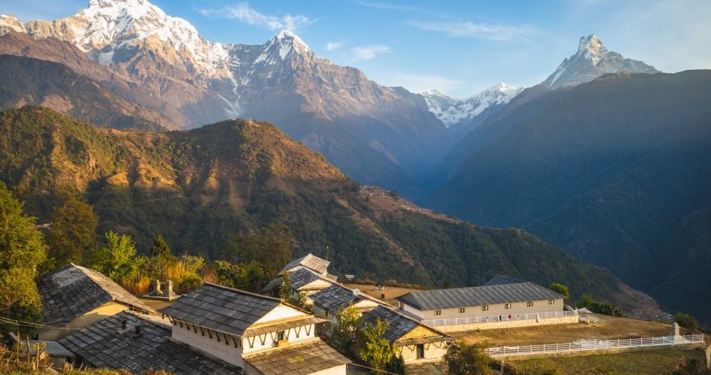
The descent becomes more gentle as the route reaches Banthanti, several hotels in the shadow of a huge rock face at 2650m, The tables and benches outside the lodge present a scene reminiscent of a ski lodge especially when there is snow. (This is not the same Banthanti that is between Ulleri and Ghorapani.) After crossing to the north side of the stream the trail starts climbing, leaving the moist, high mountain forests and entering a field of cane, making some ups and downs to the Tranquillity Guest House. Ten minutes beyond is the Clean View Lodge, on a ridge top at 2700m, offering a brief view of the mountains and also a view south to Ulleri. A rocky trail descends steeply to the Bhurungdi Khola before climbing again through forests to Tadapani, a jumble of hotels and souvenir stands at 2710m. The views of Annapurna South, Hi-unchuii and Machhapuchhare are spectacular, as the hotel names – Grand View, Super View and Fishtail View Top – suggest. Not content with the view from ground level, the Hotel Panorama Point has built a stone lookout tower.
Tadapani means Tar water and the water supply is a long distance below the village. Before the water pipe was constructed it took porters more than 30 minutes to fetch each load of water. Porters carry slabs of slate from a nearby rock quarry to make roofs for homes in Ghandruk and Melanche.
Day 2: Tadapani to Ghandruk
2-3 hours, 720m descent The Ghandruk trail descends steeply through forests to Baisi Kharict, a clearing with two hotels. There are two trails from here, both of which lead to Ghandruk. The left-hand trail follows the Kyuri Khola to join the Chhomrong-Ghandruk route and enters Ghandruk near the Shangri La Guest House. The right-hand trail makes a short, steep descent among rocks to a stream crossing, then leads out on a ridge towards Qhandiuk It reaches the top of Ghandruk near the Pioneer Boarding School and the View Lodge, then passes the Annapurna Lodge and descends on stone steps into the maze of the village itself.
Alternative Day 2: Tadapani to Chhomrong
3-4 hours, 780m descent, 280m ascent descend from the Grand View Lodge on a narrow trail through deep forests to a few houses at Miruje, then further to the very basic Hillside Lodge at Chiule (2170m). The trail them makes steep switchbacks I through com and millet fields to Siprung, passing through the courtyard of the British Gurkha Lodge at 1980m. A further descent will bring you to an old suspension bridge I over the Khumnu Khola at 1930m.
The trail starts climbing immediately to the spread-out village of Ghurjung, first reaching the school and the Buddha Guest House at 2010m. The trail passes through the yards of several homes and lodges, crossing a stream on a suspension bridge near the Hotel Green Hill. It’s then a 30-minute walk in and out of side valleys to Dhiklyo Danda at 2180m. Here the Ghandruk-Chhomrong trail joins the route. Climb for about an hour to Taglung and then make the short walk into Chhomrong at 2210m.
There is a shorter trail, but it involves more climbing. Start near the Fishtail View Top Lodge in Tadapani and descend through rhododendron forests to the Brahman village of Meianche at 2050m.
Below Meianche the trail descends steeply as it switchbacks down through com and wheat fields. It’s not easy to find the right bail ask the people in the village for directions to Kimrong. As it nears the river the route becomes less distinct, but just keep heading downhill, aiming for the only settlement you can see on the river. Cross the Khumnu Khola and join the Ghandruk-Chhomrong route, making the steep climb to Dhiklyo Danda and on to Taglung arid Chhomrong.